
Tracing a Perth Amboy Street
A Perth Amboy street directory is an address-first record trail, not a list of everyone on a road. Begin with the full address and confirm that it lies in Perth Amboy rather than a nearby delivery area. The property trail can establish a parcel, owner display, or recorded party. The historical trail can establish that a directory or newspaper used an address at a stated time. Current household membership is not a result that parcel, deed, or directory records can supply by themselves.
- Enter the address into NJGIN Property Explorer, choosing Middlesex County and Perth Amboy, then save the returned block and lot or parcel key.
- Open the Middlesex GIS parcel layer to compare the mapped parcel, its geometry, tax-block context, and displayed OwnersName field.
- Search the County Clerk’s official records by lot and block, parcel ID, legal description, town, party, or document date. Confirm the parcel before following a name.
- Use the voter-registration route only to understand official registration and election geography. It is not a public screen for listing a street’s residents.
- For an older address, check a city directory, newspaper, tax ratable, deed, or map from the same period. Preserve the published year beside the entry.
The process links address, parcel, instrument, election route, and directory evidence in that order. A common name needs at least two matching identifiers before it can be treated as the same person.
Perth Amboy Street Directory Fields
The New Jersey Geographic Information Network, or NJGIN, supplies the cleanest official first pass for a Perth Amboy address. Property Explorer searches parcels by address, county, municipality, block, and lot. Its municipality field matters because a postal place name may not match the city that controls assessment or court records. NJGIN’s statewide datasets may redact owner names under Daniel’s Law, so an empty owner field is not proof that a parcel has no recorded owner.
| Field or control | Use for a Perth Amboy address |
|---|---|
| Address | Starts from the physical parcel location, also called the situs. |
| County | Select Middlesex to keep the search in the correct county jurisdiction. |
| Municipality | Select Perth Amboy, because postal and municipal labels can differ. |
| Block | Supplies a tax-map key that can be carried into deed and map work. |
| Lot | Further identifies the parcel within the tax block. |
| Download or dataset | Provides statewide parcel data, subject to the posted redaction rules. |
Do not assume a local live owner-name form exists. The Perth Amboy assessor confirms that it maintains ownership and related parcel fields, but the official research did not verify a public city form where a person’s name can be entered to retrieve a parcel card.
Perth Amboy Parcel Map Layer
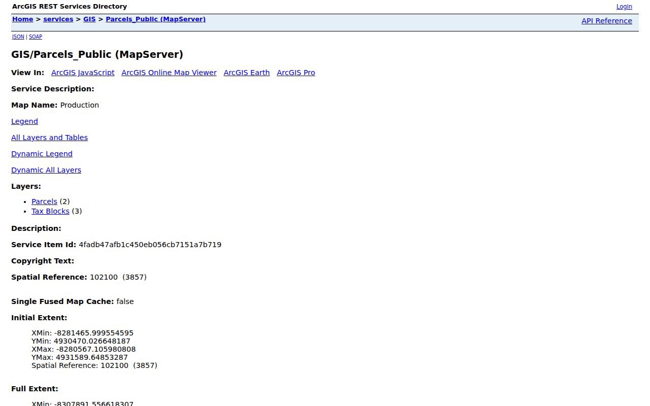
Middlesex County’s Parcels_Public MapServer provides a street-directory map layer with Parcels and Tax Blocks. The Parcels layer exposes an OwnersName display field, parcel geometry, a generated object identifier, and query controls. It can return JSON, GeoJSON, or PBF when a query uses an address, parcel, block, or other narrow constraint. The service has a maximum record count of 2,000, so a whole-city download is less reliable than a focused street or block search.
The county says parcel boundaries are updated monthly as assessor information changes in MOD-IV. Save the query date, the parcel identifier, and the source URL. Geometry helps show which land parcel lies along a named street or touches another parcel. It does not prove that a displayed owner lives at the situs, and it can lag an instrument recording or assessment change.
The Middlesex Parcels_Public MapServer is shown below. Its service page identifies the parcel and tax-block layers used for focused address research.
A corner parcel can have more than one street front, and a public right-of-way may separate two polygons. Read the map as a spatial record, then verify each parcel independently.
Perth Amboy Street Grid
Street names and route responsibility supply useful context before a Perth Amboy street directory search. The circulation material identifies Lawrence Street and Grove Street as one-way streets. Market Street, Florida Grove Road, and Amboy Avenue are county-maintained. High Street, Hall Avenue, Lawrence Street, and Grove Street are city-maintained routes. Fayette Street runs east to west, while Brace Avenue is described as the only east-west through street east of Amboy Avenue between New Brunswick Avenue and Route 440.
The city is not one uniform street grid. Second Street terminates at Sadowski Park, and streets east and west of Route 440 differ in character. Retain the direction, suffix, and street type exactly as the source records them. Avenues, roads, streets, and abbreviated directions can change a search result. No official citywide house-number renumbering schedule was located, so an old number should be tested against a tax map, legal description, Sanborn map, or contemporary newspaper before it is connected to a modern address.
Perth Amboy’s city re-incorporation in 1844 absorbed Perth Amboy Township. Older records may therefore use township, city, county, or nearby-place labels even when the later address falls in the city.
Perth Amboy Address Keys
Street directory work becomes repeatable when every search has the same worksheet. The street number and suffix identify the human-readable address. Municipality identifies the tax and court jurisdiction. ZIP helps validate mail delivery but is not a legal boundary. Block, lot, parcel ID, and legal description are stronger links between the assessor, GIS, and deed index. Store the record date and source alongside each of them.
- Situs address
- The physical location of the parcel used by assessor and GIS records.
- Mailing address
- The address where tax correspondence is sent. It can be outside Perth Amboy and does not establish occupancy.
- Legal description
- The land description used in an instrument, useful when a parcel is subdivided or a street number changes.
- Plat or tax map
- A map-based record that places a block, lot, or parcel within a mapped area.
- Criss-cross directory
- An address-first directory arrangement that may help locate a historical listing if the library holds it.
Perth Amboy has confirmed postal services for standard-delivery 08861 and PO Box 08862. A PO Box is a mailing key, not a street parcel. Use USPS to standardize an address, then use municipality and parcel fields for public-record research.
Perth Amboy Street Record Coverage
Address-keyed sources have different coverage and different people-bearing fields. The strongest street directory result states which source was used and what that source can actually support. Parcel and deed information supplies ownership or transaction context. A dated directory can supply an occupant listing. Planning records can show a project participant. Election resources identify the official registration route, not a block roster.
| Address record | Key and coverage | What it may show | Best access |
|---|---|---|---|
| Tax Assessor | Current maintained parcel record, 9,500+ properties | Owner, mailing address, situs, year built, land and structure data | Assessor office, tax map, and related parcel services |
| Middlesex GIS | Monthly MOD-IV parcel updates | Geometry, tax blocks, parcel fields, displayed owner name | Focused MapServer query |
| Official deed index | Deeds 1929+, mortgages 1950+, other documents 1958+ | Parties, document, town, date, book or page, status | County Clerk search and records room |
| City directories | Known Richmond, Polk, and National Archives runs | Dated name, address, business, or classified listing | Library, archive, or catalog route |
| Planning and board material | Record-specific city project material | Applicant, owner, project address, and board action | City material or a focused request |
Connect the sources with block and lot or legal description when possible. A street name alone can be abbreviated, reused, or associated with more than one parcel.
Perth Amboy Deed Search
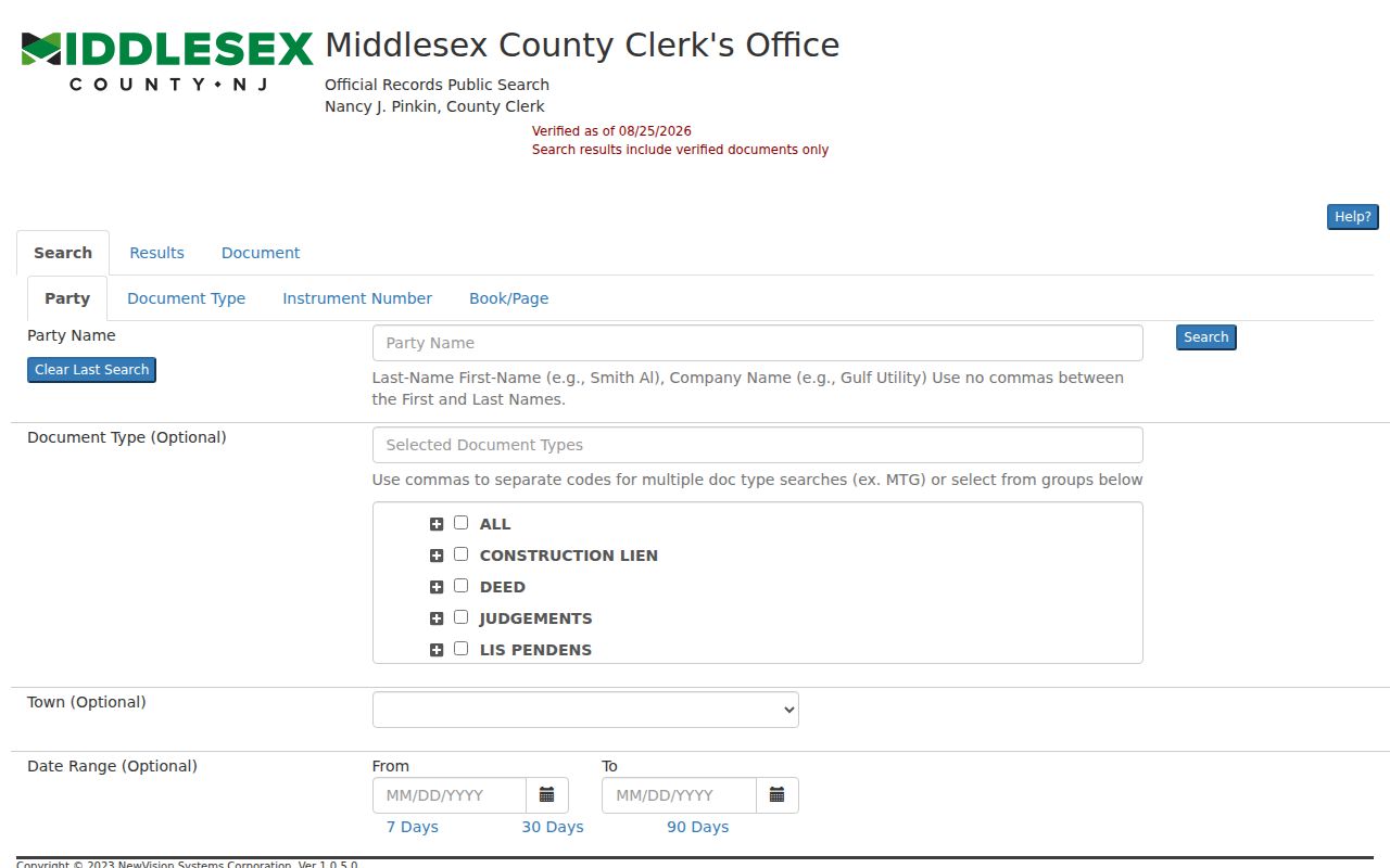
Middlesex Official Records supports several routes that are useful by street. Party Name uses the format Last-Name First-Name without commas. Town can be set to Perth Amboy. Date fields use a from and to range, and the portal also offers document type, consideration amount, instrument number, book and page, lot and block, legal description, map number, parcel fields, and parcel ID. A CAPTCHA may appear, and document-image access or payment behavior was not fully verified in the official research.
For a chain of title, enter the current parcel’s block and lot, parcel ID, map number, or legal description. Compare instrument number, date, town, status, and party role before stepping to a prior grantor. The portal’s verified markers distinguish documents with a verified status from others. Search spelling variants, especially when an older source uses initials, diacritics, a prior name, or a business party.
The Middlesex Official Records Public Search screen is shown below. It shows the portal’s party, document, and instrument search modes.
When the chain reaches before the online cutoff, continue at the County Clerk records room, State Archives deed indexes, Rutgers collections, or other documented archival holdings rather than assuming the chain ends.
Perth Amboy Historical Street Clues
A past street directory entry is a dated clue, not a current address claim. The library’s local-history resources include city directories, City Files from 1854 through 1879, yearbooks, photographs, obituary help, Perth Amboy Evening News microfilm, and Star-Ledger microfilm. Known Richmond directories run from 1912 through 1915. A 1931 R. L. Polk volume has 752 pages, and National Archives listings identify Perth Amboy-area holdings for 1929 through 1931 and 1935.
Historical directory geography is broader than a modern city search. The 1931 volume includes Woodbridge, Fords, Sewaren, and Keasbey. Pair the entry with the source’s stated place label, then test the address against the municipal parcel or deed record. The Perth Amboy directory book contains the collection-focused historical route.
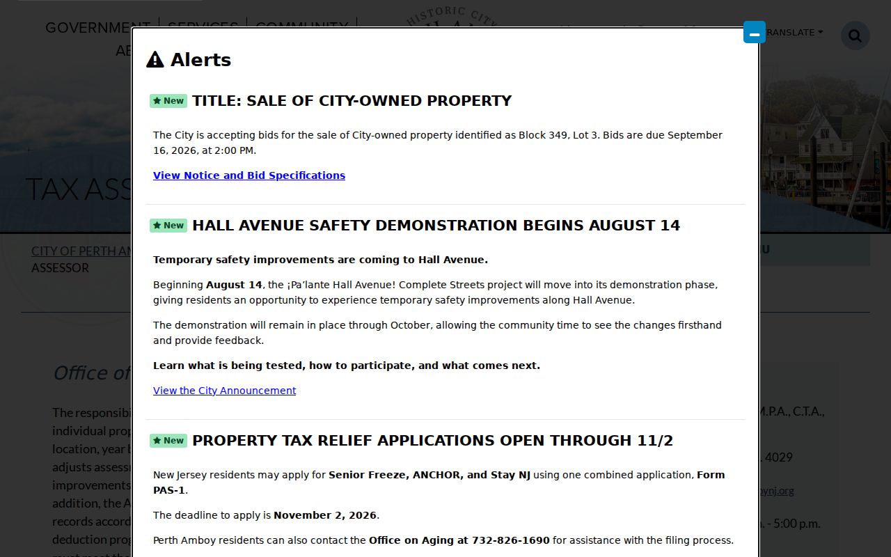
The Perth Amboy Tax Assessor page is shown below. It identifies the maintained parcel data and the City Tax Map connection that can help compare an old address with a present parcel.
For the nineteenth century, the 1891 twelve-sheet Sanborn map can connect a street number to building footprints and nearby structures, but it is spatial evidence rather than a person index.
Perth Amboy Voter Geography
The state voter system is useful for registration status and election information where the official interface permits it. N.J.S.A. 19:31-31 describes statewide voter-system fields, including address, municipality, ZIP, ward, and election district, along with many protected or nonpublic details. The live registration-check form was blocked during research, so its exact labels, required fields, and result display should not be guessed from the statute.
For an address search, use the voter route to identify an election-geography question, then contact the Middlesex Board of Elections when official assistance is needed. Do not treat the voter system as a street directory or publish names from it. The voter statute restricts commercial or charitable solicitation use, and a registration result does not prove who currently occupies the parcel.
Note: A ward or election district describes administration, not everyone living on a street or block.
Perth Amboy Planning Records
Address history can also appear in city planning, zoning, redevelopment, Historic Preservation, and board material. These records may identify an applicant, owner, project address, or final board action. The city zoning route includes parcel-zoning, redevelopment-plan, and Special Improvement District context. The municipal boards index identifies the agencies that may hold agendas or minutes. A complete searchable archive and retention run were not verified, so use a posted record first and then make a narrow request for the exact address and date range.
Permit and code records can date an alteration, demolition, change of use, or inspection outcome. They are supporting evidence, not a household list. A named applicant can be an owner, contractor, agent, architect, or business representative. Confirm the role against the parcel and the recorded instrument before tying the name to the address.
Perth Amboy Street Search Limits
A street directory cannot show every person present at an address. Public parcel, deed, and GIS records do not list household members, visitors, utility customers, delivery recipients, or protected people. The voter lookup is not an everyone-on-this-street screen. A historical directory can show a name at publication time, but it cannot be used to fill a current block roster. DMV address information is restricted under the Driver Privacy Protection Act.
Daniel’s Law and the Address Confidentiality Program can limit public display of an address or name. A blank GIS field may reflect redaction or a service limitation. Record that restriction, keep the source date, and ask the responsible custodian about an eligible correction or access route instead of attempting to reconstruct protected information.